Unmanned Aerial Vehicles (UAVs), or drones as we call them, are a pretty big deal. Not just to the serial hobbyist or the travel-instagrammer who needs that perfect selfie, but for commercial and industrial purposes too. Drones can do any number of things. Amazon even has plans to deliver packages in the US via drone, and you could just about imagine a sky full of drones delivering crisps and emergency toilet paper to offices. You can’t even shoot them down anymore since it’s a crime. (Americans love guns so much, that you have to legislate what they can’t shoot. Go ‘Murica!) But seriously, having a lightweight aerial craft that can stay up to 60 minutes in the air has tremendous application for any number of industries. It’s not just about buzzing dogs and joggers in the park. When it comes to traffic, surveillance, agriculture, construction, or disaster management, drones can be tremendously useful.
Usually, you’d find all the good drone tech concentrated in the West, and it would take some time to filter down to Sri Lanka. But happily, not in this case.
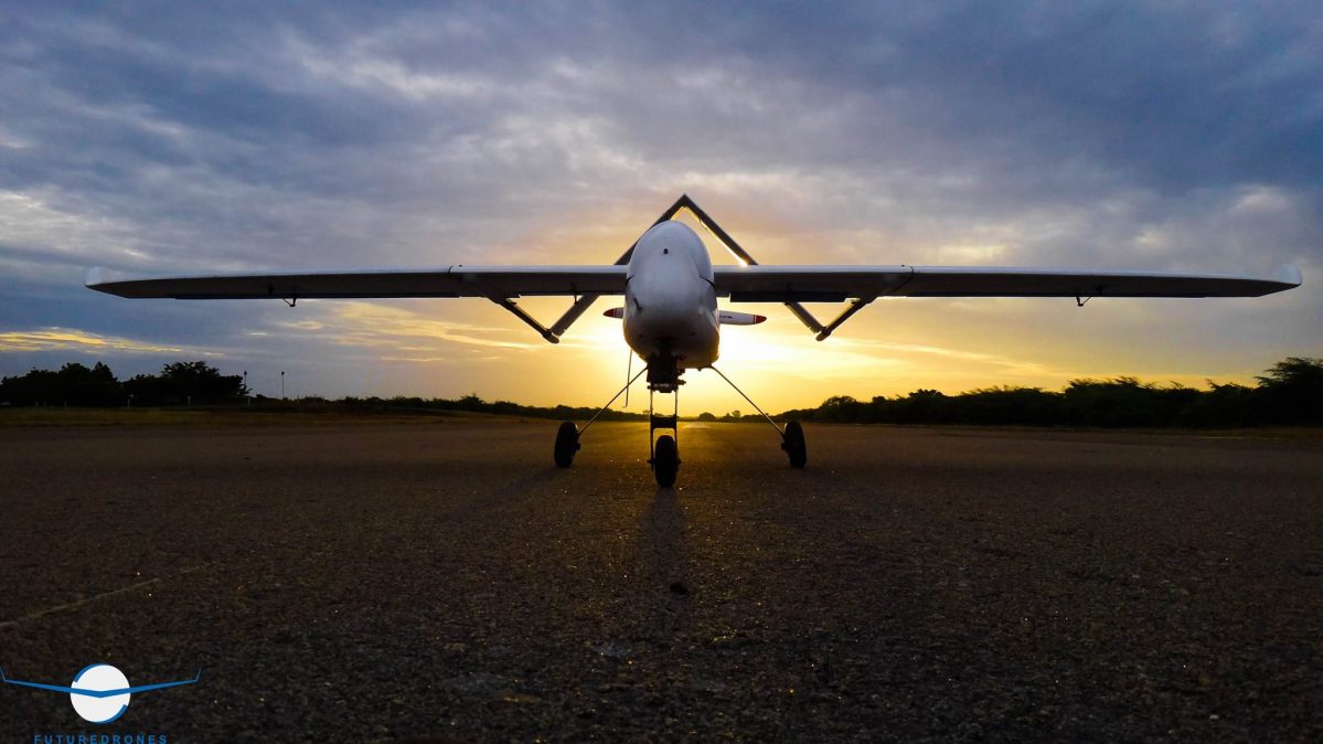
Sri Lankan manufactured drones. Image courtesy: Future Drones
Late 2014, the University of Moratuwa’s Engineering Faculty launched the CeyHawk at the opening of its UAV research lab. The CeyHawk was a large UAV with fixed wings, as opposed to the quadcopters you’d normally see. This lead to the creation of a company called Future Drones that operates out of the “Vibhava” Product Accelerator, at the Department of Electronic and Telecommunication Engineering of the University of Moratuwa. The company designs and builds drones for more industrial applications like surveying, mapping, urban planning, and research. They’ve been in talks with the Survey Department and the Disaster Management Centre to use their drones for projects, and hopefully we’ll get to see some governmental adoption.
The drones themselves are pretty robust creations with high-end specs. The fixed wing drone is a much simpler structure than a rotary wing, and though it makes the entire thing larger, it also means much easier maintenance and repair.
Chamika Gamage of Future Drones tells us that their machines are mostly used in agriculture and for mapping purposes, and that they have 3 types of drone right now: the CeyHawk, the CeyMapper, and the Ceybee, which is the smallest.
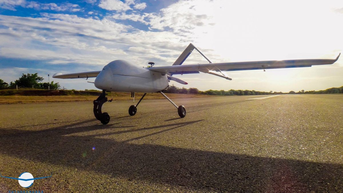
The CeyHawk. Image Courtesy: Future Drones
The CeyHawk is the biggest drone on offer, weighing in at a hefty 10 kg, having a wingspan of 2.67 m and running on gasoline with a fuel capacity of 3000cc. To get the bird in the air, you’ll need to launch it from a catapult or a runway. It can cover 80 km² and has a maximum speed of 120 km/h. The CeyHawk can stay airborne for 3 hours and has a 24Mp Sony camera. To get it back on the ground, the pilot can either manually land it or use the parachute attached to the drone for recovery in case there isn’t enough space to land. There is also a failsafe built in that returns the craft to the spot where it was launched. The drone is mainly used for industrial purposes, such as mapping large areas of land. If it needs to, it can carry packages of up to 1.5 kg.
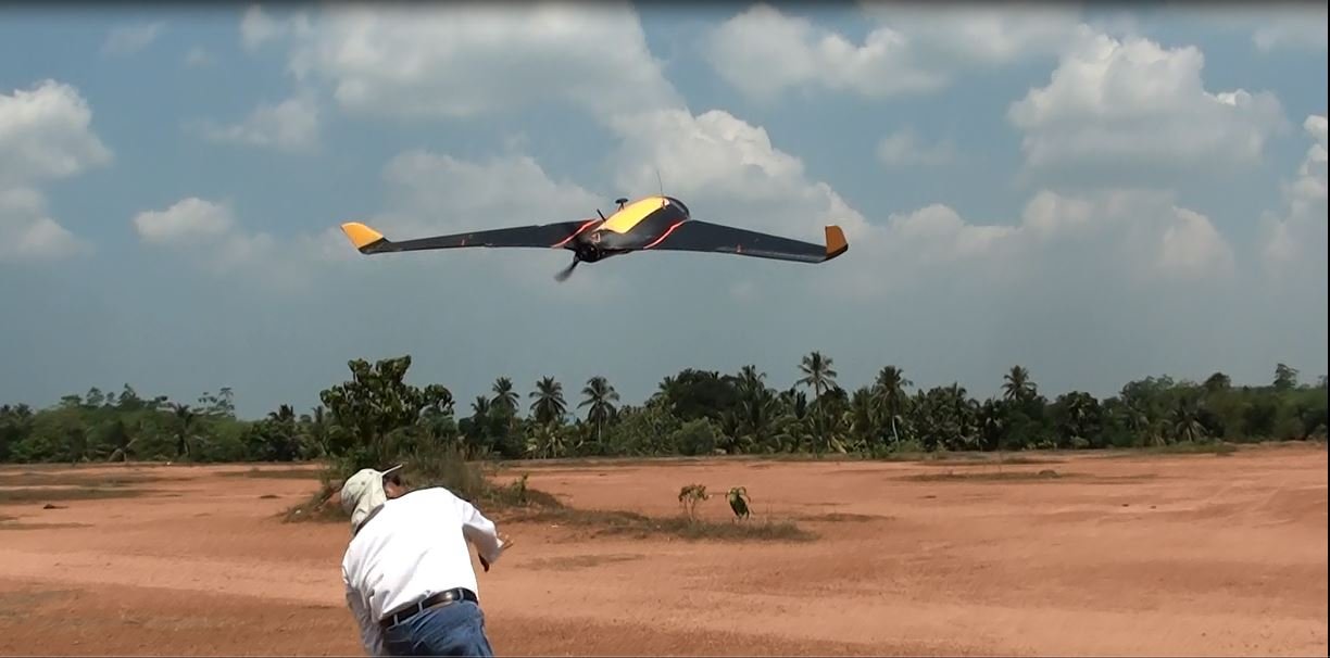
Hand launching the CeyMapper. Image Courtesy: Future Drones
The CeyMapper is a smaller drone weighing in at just 3.5 kg, but with a wingspan of 2.2 m. The drone also runs on an 8000 mAh battery instead of liquid fuel, which is about the same capacity as an iPad battery. The CeyMapper can cover 7 km² and stay up in the air for over 45 minutes. The drone also has a 24Mp Sony camera, and can be launched by hand, through a catapult, or from the top of a car. Its uses are mostly for low-range mapping and real-time video. The drone can loiter, and land automatically, and also has a failsafe that lets it return to its point of launch. In case of emergencies or if there is not enough space to land, the CeyMapper has a parachute to enable recovery.
Launch and recovery of the CeyMapper
The CeyBee is their newest and smallest fixed-wing drone, weighing in at just 1.5 kg and running off a 5000 mAh battery. The drone can stay up in the air for over 40 minutes and cover 3.5 km². It also has a camera similar to its bigger cousins and can be launched by hand. The CeyBee is used for more lightweight tasks that require video and light aerial surveillance. This drone can loiter, and land linearly and automatically, unlike the bigger drones.
The drones have carbon fibre bodies, and the ones used for mapping have long range remote controls (25 km+) and mapping sensors and mission planning software. The drones are not too complicated to use, but require some basic know-how to operate. Future Drones provides some basic training on using the equipment and also customises their solutions for clients. They’ve also got smaller multi-copters for a variety of other uses.
While drones are pretty popular in Sri Lanka, it’s not well known that Sri Lanka manufacturers its own, especially of the industrial variety. The possible uses of drone tech in Sri Lanka is enormous. Using drones for agriculture, geological survey, forestry, and disaster management can greatly enhance the work and effectiveness of government departments and private institutions. Drones are here to stay in Sri Lanka, and we’re just skimming the surface of their potential.


